
La Graciosa
A 29 km² volcanic island off the northern tip of Lanzarote, reached only by a 25–30 minute ferry from Órzola. Recognised in 2018 as the eighth inhabited Canary Island, it has one village with sand streets, no private cars and beaches inside the Chinijo Archipelago Natural Park.
- Status
- 8th inhabited island, recognised 2018
- Municipality
- Teguise (Lanzarote)
- Access
- Ferry from Órzola, about 25–30 min; no airport
- Protected area
- Chinijo Archipelago Natural Park
- Roads
- Sand tracks only; no private cars
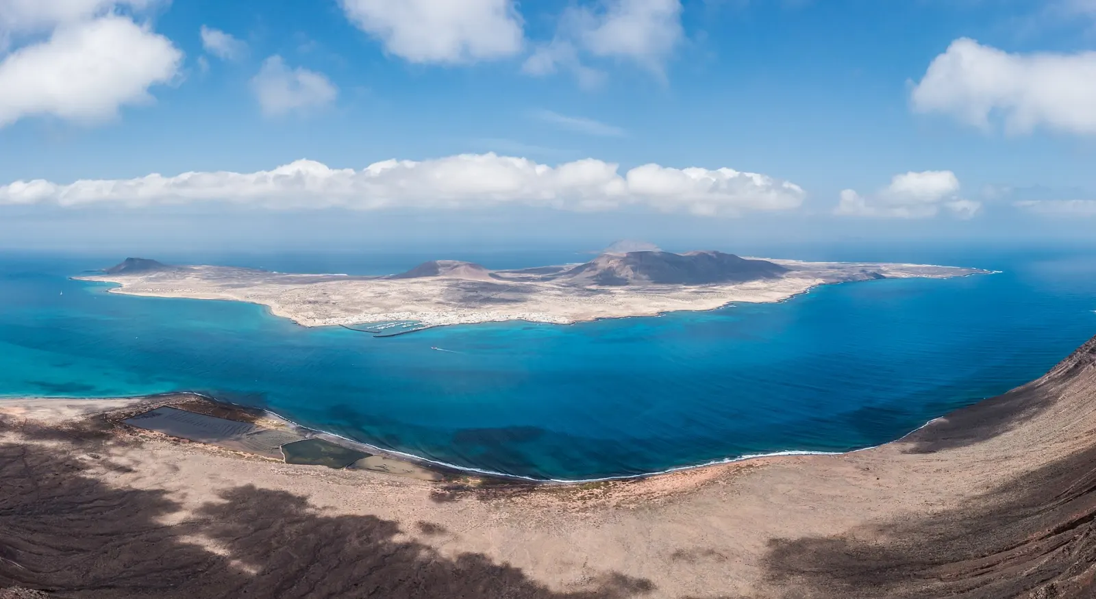
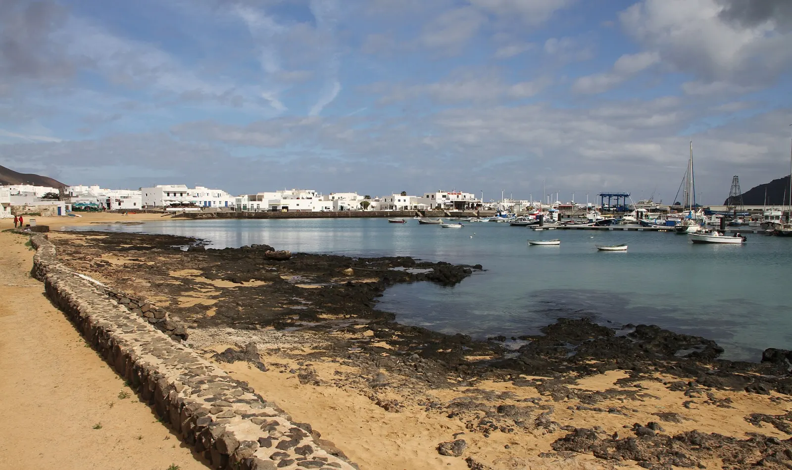
La Graciosa is a small volcanic island of about 29 km² lying across a narrow strait, El Río, from the northern cliffs of Lanzarote. Its 734 residents (2024, INE) live almost entirely in Caleta de Sebo, a harbour village with sand streets and whitewashed houses. There is no airport and no road link: the only public access is a ferry crossing of about 25–30 minutes from Órzola. Go for long walks or bike rides across volcanic plains, quiet beaches with clear water and a day without traffic.
Why is La Graciosa called the eighth Canary Island?
For a long time the Canary Islands were described as "seven islands", the seven with their own island government (cabildo). On 26 June 2018 the Spanish Senate's committee on autonomous communities unanimously approved a motion recognising La Graciosa as the eighth inhabited Canary Island. The reformed Statute of Autonomy of the Canary Islands (Organic Law 1/2018) then named La Graciosa explicitly as part of the archipelago, alongside the seven main islands, while keeping it administratively attached to Lanzarote. In practice, La Graciosa still belongs to the municipality of Teguise and has no cabildo of its own.
What is there to see?
The island is part of the Chinijo Archipelago Natural Park, together with the uninhabited islets of Alegranza, Montaña Clara, Roque del Este and Roque del Oeste, and lies within the Lanzarote and Chinijo Islands UNESCO Global Geopark (2015). The landscape is made of volcanic cones, including Agujas Grandes, its highest point at 266 m, and Montaña Amarilla, separated by sandy plains.
- Playa de las Conchas: a wide beach in the north-west facing Montaña Clara, often considered the most striking on the island. It is exposed to the open Atlantic, with strong currents and waves on many days, so it is better for walking and sunbathing than swimming.
- Playa Francesa and the beaches near Caleta de Sebo: more sheltered, facing the strait, and usually calmer for a swim.
- Montaña Amarilla: a yellowish volcanic cone in the south with a small cove at its foot.
- Pedro Barba: a tiny settlement in the east, now mainly used by temporary residents rather than as a full-time village.
How do you get around La Graciosa?
All streets and tracks are unpaved sand, and private cars are not permitted; only a small number of licensed vehicles operate, including 4x4 taxis that can take visitors to the more distant beaches. Most people walk or rent a bicycle in Caleta de Sebo. Sand tracks are tiring on a bike, distances to the northern beaches are significant in the heat, and there is almost no shade outside the village, so carry plenty of water, sun protection and a hat.
What should you plan before going?
- Ferry: Líneas Romero and Biosfera Express run frequent daily crossings from Órzola, with an average crossing of about 25–30 minutes; the sea in the strait can be rough, so check sailings on windy days.
- Services: shops, restaurants, bike hire and a few places to stay are concentrated in Caleta de Sebo. Outside the village there are no facilities.
- Respect the protected area: stay on existing tracks, do not build stone shelters or take shells and sand, and take your rubbish back with you.
- Overnight stays: a night or two on the island lets you see it after the day visitors leave on the last ferries, when it is at its quietest.
When should you go?
La Graciosa shares Lanzarote's dry, sunny and windy climate. Spring and autumn are comfortable for walking and cycling; summer days are hot and the trade winds strong, which can make the open beaches choppy. The island is busiest on summer weekends and holidays, when many Lanzarote residents visit.
How does La Graciosa fit into a trip?
Most visitors come as a day trip or a short stay from Lanzarote. Combine it with the Mirador del Río, the César Manrique viewpoint on the cliffs above the strait, which offers the classic view of the whole island, and with the northern sights of Lanzarote such as the Jameos del Agua. Compare all eight islands in which Canary Island is right for you.
Weather this week
All islands →Forecast for Caleta de Sebo
Where to stay in La Graciosa
Pick the area first — it shapes the whole trip.
Places to see
See all →Getting there
By air: La Graciosa has no airport. Fly to César Manrique-Lanzarote Airport (ACE) and drive or take a bus/taxi to Órzola at the northern tip of Lanzarote.
By ferry: Líneas Romero and Biosfera Express sail Órzola–Caleta de Sebo several times a day, year-round; the crossing takes about 25–30 minutes depending on the sea. In peak periods buy tickets in advance and check the last return sailing.